Environmental &
Firefighting
Drone Solutions in
Action
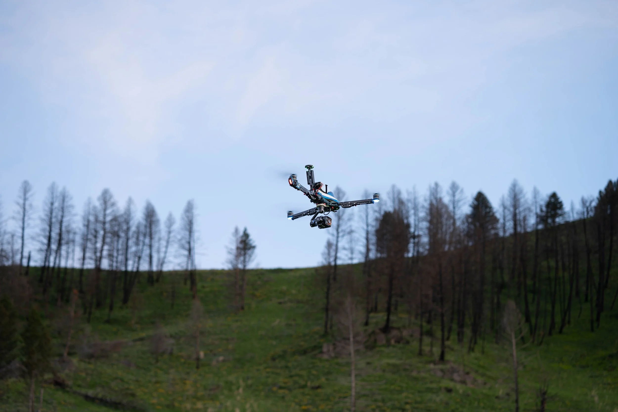
Vulcan SX + FLIR Hadron 640R
Wildfire Hotspot Detection
Deploy thermal-equipped drones mid-fire or during mop up to identify smoldering pockets and prevent reignition. Map and track fire perimeters.
What should I fly?
Drone: Vulcan SX — Long flight times combined with the Indefinite Flight Package help you stay in the air as long as you need so you can assess, report, and start taking action.
Payload: FLIR Hadron 640R— One of the lightest dual thermal and visible payloads on the market, the Hadron 640R has great visibility through smoke and haze. You can also choose from several thermal color palettes to be able to more quickly see what you need.
Alternative bundle: Vulcan SX + GeoCue TV 1 — Drones flying high resolution cameras can help you safely and quickly get detailed views — scanning vast areas, difficult terrain, or risky areas can improve situation awareness for suppression planning.

Vulcan SX + FLIR Hadron 640R
Prescribed Burn Monitoring
Track fire behavior in real time to ensure safe, controlled outcomes. Monitor drift, intensity, and containment from the air, while recording every pass for post-burn evaluation.
What should I fly?
Drone: Vulcan SX — Range, durability, and payload versatility of the Vulcan SX enable you to respond to the scenario at hand, rather than having to conform to your drone’s limitations.
Payload: FLIR Hadron 640R — Use thermal imaging to quickly find hotspots, even before you can see them with the visible eye. And a quick switch to the high resolution RGB view means you can also get great situational awareness on the same mission.
Alternative bundle: Vulcan SX + Sony ILX-LR1 — In the heat of the day, smoke may be easier to see using high res optical imaging vs thermal. Consider the missions you fly when determining thermal vs optical.

Vulcan SX + Sony ILX-LR1
Forestry & Land Management
Track and monitor deforestation, whether tracking treelines or even counting trees. High resolution sensors can help you quickly analyze change in land use or even habitat degradation. More advanced sensors can pinpoint changes in forest health and manage land for biodiversity.
What should I fly?
Drone: Vulcan SX — If you’re managing forests or land, the Vulcan SX delivers the trifecta of long range, high endurance, and superior flexibility.
Payload: Sony ILX-LR1— The high resolution of the ILX-LR1 can get you enough detail that you can literally count trees in the forest.
Software: Pix4D— Boost your tools by adding the processing capaiblity of PixD for detailed 2D, orthomosaic, or even 3D images.
Alternative bundle: SwitchBlade-Elite + MicaSense Altum-PT— Multispectral sensors can identify smaller changes in vegetation, giving you leading indicators of forrest health and vegetation stress.
Other Use Cases
Whether you're mapping fire perimeters, detecting hotspots, or monitoring ecological change, our drones help you act sooner and with greater accuracy — without risking pilot safety or waiting on satellite passes.
Post incident analysis and damage assessment: Whether land or structure, get close more safely in order to analyze the situation and plan your resources and response.
Recommended bundle: Vulcan SX + Sony ILX-LR1
Post-fire vegetation mapping: Use NDVI/multispectral payloads to analyze regrowth, soil stability, or burn severity.
Recommended bundle: Vulcan SX + Resonon Pika series
Post-fire mop-up: Whether following a prescribed burn or a wildfire, it’s necessary to quickly deploy and monitor for hotspots and other issues.
Recommended bundle: Vulcan SX + FLIR Hadron 640R or Sony ILX-LR1
Fuel Load Measurement: Proactively measuring and planning based on fuel load is a critical component of forest management.
Recommended bundle: Vector + GeoCue TV 1
Habitat mapping and assessment: Create detailed 2D and 3D maps of terrain, vegetation, and land cover. Map and monitor protected areas, including coastal erosion and glacier movements. Identify and categorizing vegetation, including invasive species. Assess vegetation health and canopy cover.
Recommended bundle: Vulcan SX + MicaSense RedEdge-P
Live Mapping for Incident Command: Support IC (incident command) decision making by generating real-time orthomosaics showing up-to-date fire lines, terrain, and movement.
Recommended bundle: Vulcan SX + Sony ILX-LR1
“Having access to raw data makes it more versatile for new projects while we’re cooking up the next thing.”
- Key researcher at MSU -
Why do you need Vision Aerial
in your Environmental & Firefighting Drone Toolbox
Built to work.
Built for heat, wind, dust, cold, and smoke. No flimsy airframes or fragile payload mounts.
Portable.
Rapid deployment and in-field configuration gets you in the field, at the incident or on the job, on time.
Versatile.
Cover more area with fewer battery swaps — ideal for wildfire mapping and monitoring remote terrain.
Adaptable & upgradable.
Compatible with Pix4D, DroneDeploy, and other mapping tools for fast georeferenced outputs.
FAQ
Can your drones be used during active wildfires?
Yes. Our systems are rugged and field-tested for heat, wind, and low-visibility conditions. We always recommend following FAA and agency coordination protocols. While visibility for the pilot is a factor, our systems can operate in light to moderate smoke, with thermal payloads still detecting heat through haze.
Can I fly your drones in smoky conditions?
Yes. While visibility for the pilot is a factor in order to maintain required visual line of sight (unless you have a waiver), our systems can operate in smokey conditions. Thermal payloads can detecting heat through haze for hotspot detection, perimeter mapping, or even search and rescue.
Can we generate burn severity maps with your drones?
Yes — with multispectral or high-res RGB sensors, our drones integrate with mapping software that supports burn severity classification.
How do you handle data processing?
Vision Aerial drones and payloads support seamless data handoff to Pix4D, ESRI, and other industry-standard GIS tools. We also offer workflow consulting for rapid turnaround.
Do you support fire agency procurement processes?
Absolutely — we work with city, county, and federal agencies across the U.S., and provide sole-source documentation when applicable.