Utilities
Drone Solutions in
Action
Vulcan + Sony ILX-LR1
Power Line Inspections
Fly close and steady, even in crosswinds, with high-res cameras and zoom optics to find corrosion, hotspot, or encroaching vegetation. Add zoom-enabled optical sensors, thermal cameras, or even LiDAR to meet even more use cases such as detecting conductor sag or damaged insulators.
What should I fly?
Drone: Vulcan SX — Electromagnetic interference (EMI) resistance is a must, but that’s not all of the story. Advanced stabilization of the Vulcan SX gives you the ultimate control to avoid obstacles, even as you get close enough to complete the job. And cruise-optimized power usage means you can fly long and far to get to the end of your job. For sensitive infrastructure, add on the Pro Package, which indicates Safe to Fly.
Payload: Sony ILX-LR1— High resolution is a must for detailed power line inspections.
Accessories: RTK ProfiCNC GNSS — Small measurements can mean all the world when it comes to detecting issues, and the RTK GNSS add-on can measure to 5 cm accuracy.
Alternative bundle: SwitchBlade-Elite + FLIR Hadron 640R— Thermal imaging can detect hotspots before you can even see it, helping you proactively identify and plan repairs before they become a problem.
Vector + Workswell Wiris Enterprise
Solar Panel Audits
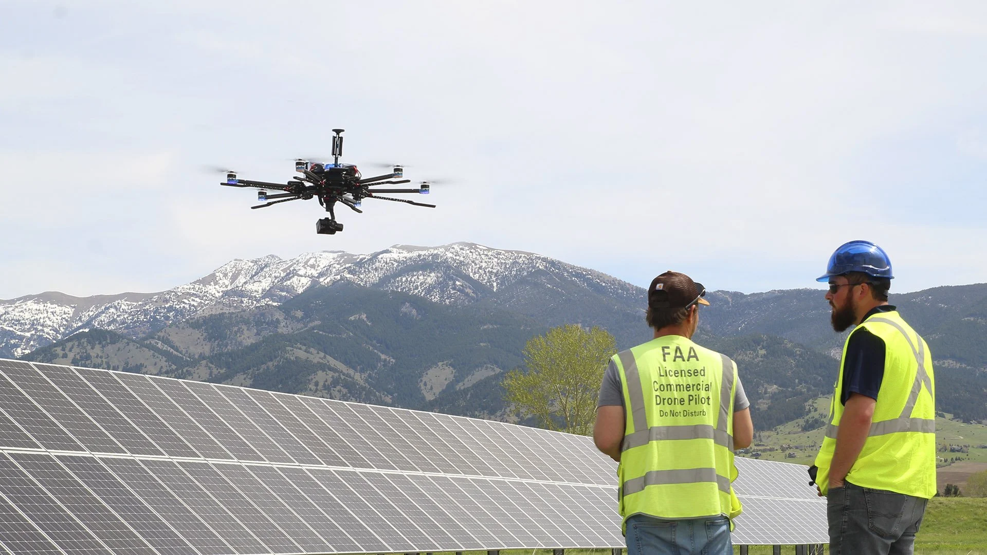
Capture thermal imagery to identify underperforming or damaged panels across large utility arrays.
What should I fly?
Drone: Vector— The heavy-lift hexacopter can go the distance that is often required for solar panel audits.
Payload: Workswell Wiris Enterprise— The dual thermal and visible imager will enable you to inspect with thermal and visible at the same time to more easily identify needed repairs, plan the work, and confirm completion.
Alternative bundle: Vulcan SX + FLIR Hadron 640R — When you have a lot of sites to inspect, the SWaP (size, weight, and power) optimized Vulcan SX + Hadron 60R means the whole system is more portable even while keeping field-swappable payloads.
Vulcan SX + Sony ILX-LR1
Tower Inspections
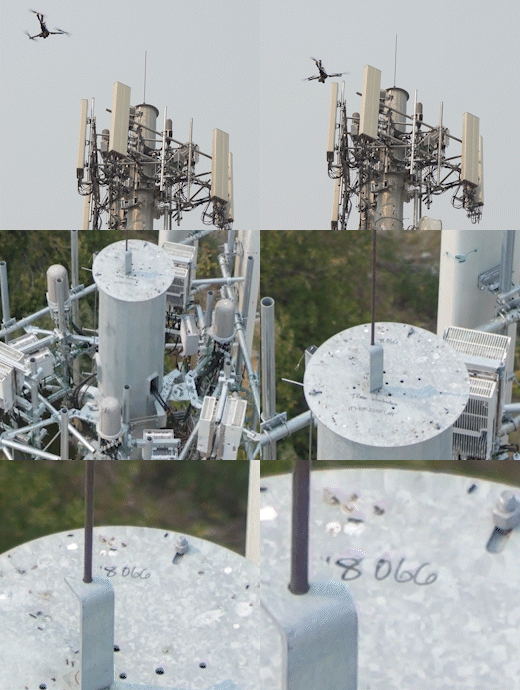
Tower inspections have their own unique needs — you can’t just put a camera on a drone and fly.
What should I fly?
Drone: Vulcan SX — The Vulcan SX’s VTOL (vertical takeoff and landing), excellent hover ability, and key functions in the Flight Deck TowerScan software make it just the drone solution to make your job easier.
Payload: Sony ILX-LR1 — Need to see the literal nuts and bolts? Read numbers on the tower? Assess leased equipment on your tower? The ILX-LR1 can see everything you need to see.
Software: Vision Aerial Flight Deck with TowerScan — Mark your points and go. It really is that easy.
Other Use Cases
Whether you’re surveying solar farms, inspecting towers, or assessing storm damage, our rugged platforms help reduce manual labor, improve data quality, and cut costs.
Storm triage: Quickly survey damage to grid infrastructure after hurricanes, snowstorms, or tornadoes — getting crews on-site faster.
Recommended bundle: Vulcan SX + Sony ILX-LR1
Vegetation encroachment: Record and monitor vegetation encroachment for planning and control.
Recommended bundle: Vector + GeoCue TV 1
Corridor mapping: Create quality othomosaics or 3D models to help with planning, construction and management.
Recommended bundle: Vector + GeoCue TV 1 + Pix4D
Substation and plant surveys: Fly in complex environments such as lattices, trusses and wires with advanced maneuverability, control, and safety features. In addition, EMI resistance helps maintain stable flights and produce quality images.
Recommended bundle: Vulcan SX + Sony ILX-LR1 or GeoCue TV 1, with the RTK GNSS accessory
Infrastructure modeling and maintenance planning: Generate high-fidelity 3D models for planning, retrofits, or predictive maintenance. Use the data in Building Information Modeling (BIM) or asset management systems.
Recommended bundle: Vulcan SX + Sony ILX-LR1 + Pix4D, adding RTK GNSS for even more precision
Why do you need Vision Aerial
in your Utility Drone Toolbox
Built to work.
Operate in complex environments with the care and safety you need, every time you need it.
Portable.
Fly where and as long as you need to with efficient airframes and power systems for large-area or linear assets.
Versatile.
Carry advanced inspection tools — even heavy ones — without compromising performance. Swap payloads in-field.
No nonsense support.
Modular design and intuitive controls are easier to field train, which also means reduced support calls.
FAQ
Are your drones radiation hardened for powerful communication arrays?
Absolutely. And this is a key question to clarify with any other drone manufacturer. Being able to fly near transmission lines is not the same as being able to fly near communication arrays. Vision Aerial drones can do both.
Can your drones fly near high voltage energized lines?
Vision Aerial drones are tested, and field-proven, to fly near high voltage energized lines. While it is important to have proper clearances and training, our systems offer precise control and stability for close inspections. We also work with partners to ensure safe SOPs.
Can your drones integrate with our inspection software?
Yes. We support integration with tools like Utility Cloud, ESRI, and custom APIs. Data is easily exportable in multiple formats, depending on the payload.
What about compliance and safety protocols?
Our platforms meet or exceed FAA Part 107 requirements and are used by certified operators across multiple regulated industries.
What’s the advantage of flying a drone over helicopter flyovers?
Lower cost, safer operation, and higher-resolution data — especially for close-range and repeatable inspections. If you use a helicopter for longer range missions, drones still have a place in your toolbox to do quick re-checks, confirmation of repairs, and additional documentation.
Do you offer solar-specific packages?
We offer turnkey solutions with thermal sensors and preconfigured flight plans for solar thermography, including vegetation index overlays.


