Browse by Tags
- AEC drones
- Advancing Skills
- Aerial Mapping
- Aerial Mapping Drones
- Agriculture
- American drone manufacturer
- Awards
- Black Herelink
- Blue Herelink
- Case Studies
- Construction Drones
- CubePilot
- Drone payload mounting options
- Events
- Firefighting
- GSD
- Gas Detection
- GeoCue TV 1 Lite
- Getting Started
- Hadron 640R
- Haul Road Analysis
- Herelink
- Herelink Tablet Mount
- Hyperspectral Payloads
- Industry News
- Inspection
- Inspection Drones
- Mapping
- MarkPoint
- Meda Coverage
- Media Coverage
- Methane Detection
- Mining
- News
- OGI Payloads
- OGI Scout
- Oil & Gas
- Optical Gas Imaging
- Orthomosaics
- Part 107
- Partnership
- Photogrammetry
- Pix4D
- Plant Disease Detection
- Press Release
- Processing Software
- Promotions
- Public Safety
- QGC
- QGround Control
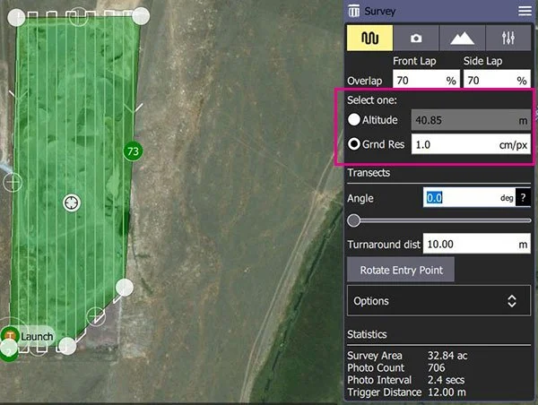
How to Plan a Survey Flight and Determine Ground Sample Distance in QGroundControl
Ground Sample Distance is a critical measurement in photogrammetry. This article covers how to use QGroundControl to determine your GSD.
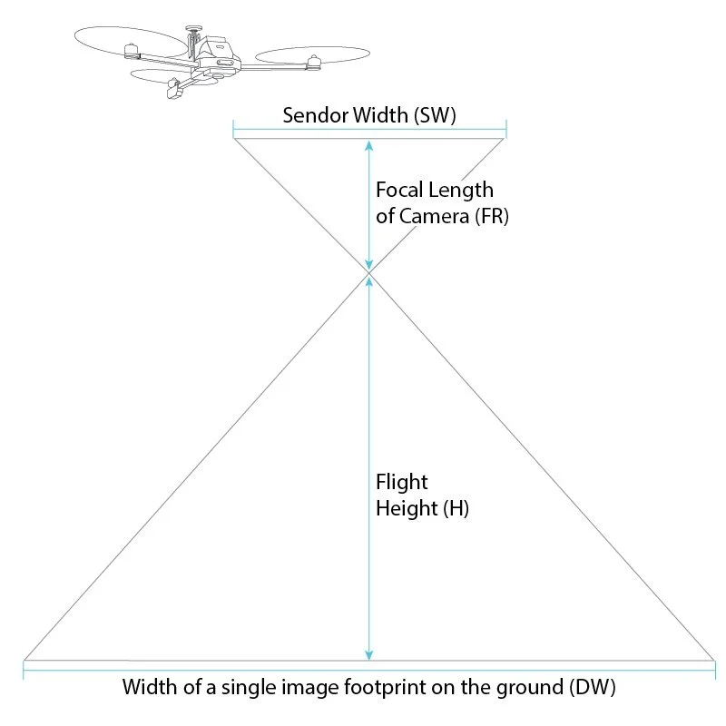
What is Ground Sample Distance (GSD)?
GSD is an important metric to understand in photogrammetry and is directly related to how accurate your survey is. This article explains how to calculate your GSD.

What is the Difference Between GCPs, PPK, and RTK?
This overview can help you determine which GPS correction method is best for your project.
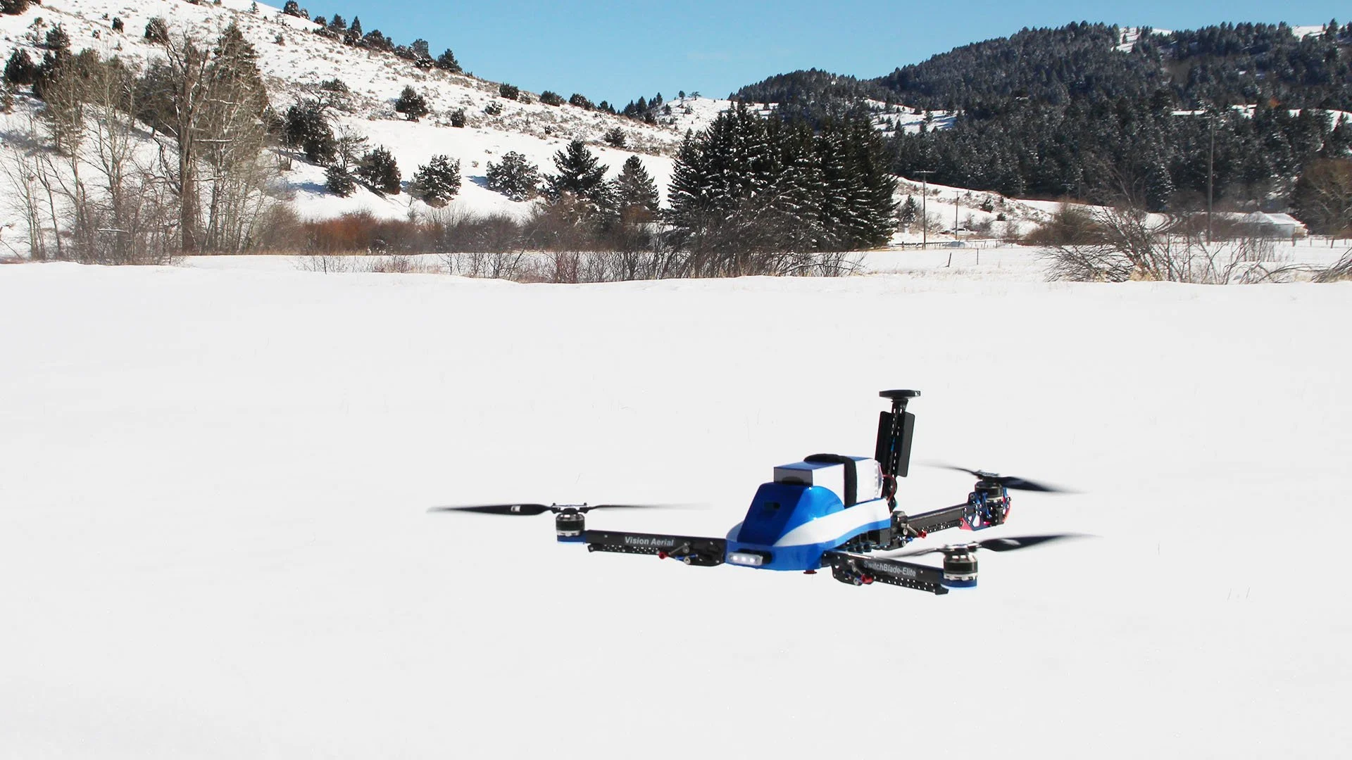
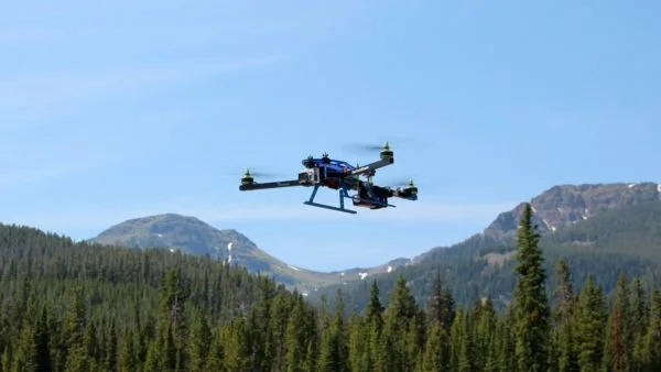
Benefits of a Tri-Rotor Drone
The engineers at Vision Aerial have determined that a tri-rotor drone design is more efficient and easier to fly than a quadcopter. Here's why.
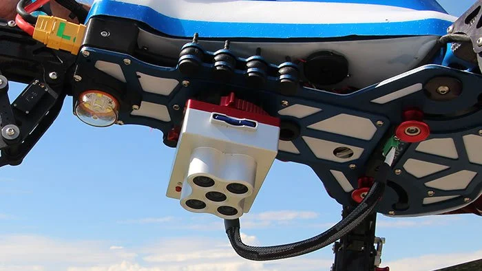
What is Fixed Nadir Payload Mounting on a Drone?
Fixed nadir payload mounting means that the payload is attached to the belly of the aircraft, pointing straight down at the earth in a static position.
FAA Releases Commercial Drone Rules (Part 107)
Summary of new Part 107 rules from the FAA for commercial drones.