Browse by Tags
- AEC drones
- Advancing Skills
- Aerial Mapping
- Aerial Mapping Drones
- Agriculture
- American drone manufacturer
- Awards
- Black Herelink
- Blue Herelink
- Case Studies
- Construction Drones
- CubePilot
- Drone Design
- Drone payload mounting options
- Events
- Firefighting
- GSD
- Gas Detection
- GeoCue TV 1 Lite
- Getting Started
- Hadron 640R
- Haul Road Analysis
- Herelink
- Herelink Tablet Mount
- Hyperspectral Payloads
- Industry News
- Inspection
- Inspection Drones
- Mapping
- MarkPoint
- Meda Coverage
- Media Coverage
- Methane Detection
- Mining
- News
- OGI Payloads
- OGI Scout
- Oil & Gas
- Optical Gas Imaging
- Orthomosaics
- Part 107
- Partnership
- Photogrammetry
- Pix4D
- Plant Disease Detection
- Press Release
- Processing Software
- Promotions
- Public Safety
- QGC
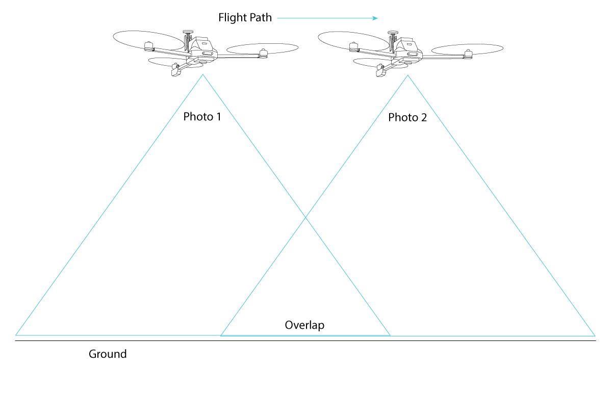
Aerial Survey Guide for Vision Aerial Drones
Key considerations for planning and executing an aerial survey using Vision Aerial drones.
Verified! 19+ km Control and Telemetry Range
Vision Aerial tested and verified the range claimed for the Herelink.
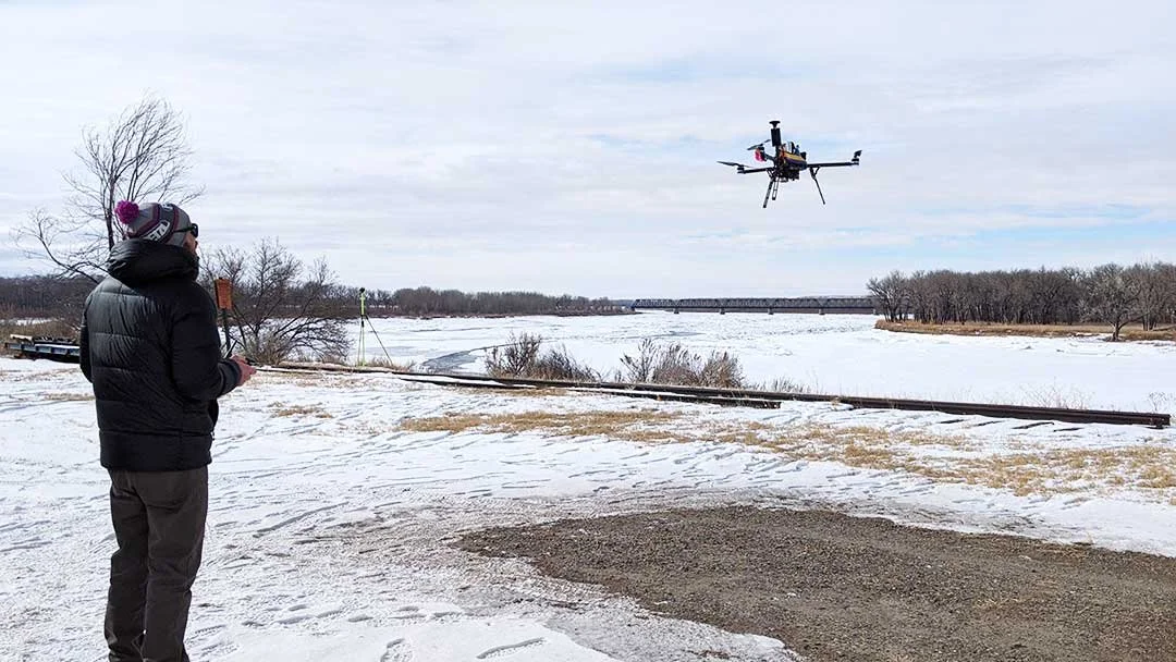
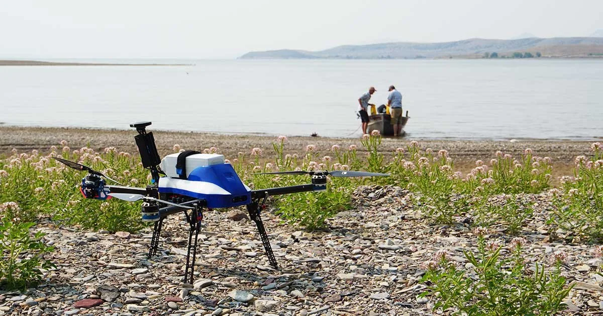
Case Study: Montana State University Uses Scientific Research Drones
Montana State University research team uses SwitchBlade-Elite research drone to measure river ice thickness to predict seasonal flooding.

How to Use Ground Control Points to Improve Drone Survey Accuracy
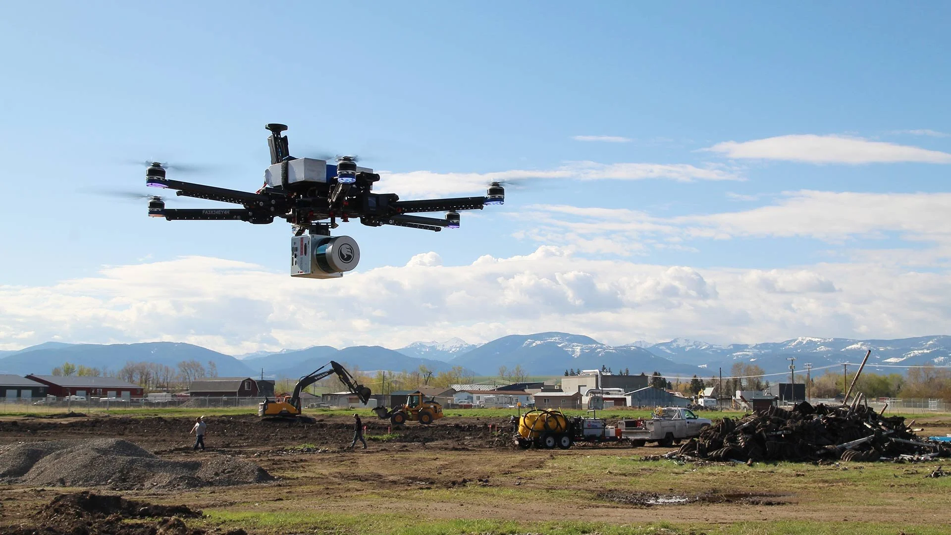
Benefits and Major Uses of Drones in Construction
Drones have changed the way the construction industry works and have provided numerous benefits. This article covers the major uses and benefits emerging from the use of drones in construction
Drones Made in America: Why the Big Push and What is the Solution?
Security concerns, data leaks, and several other events over the past few years have invigorated a push for drones made in America. Vision Aerial is an American drone manufacturer and has NDAA compliant options for government customers.
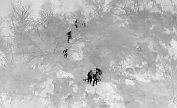
How to Use Drones for Search and Rescue
Search and rescue drones are becoming popular tools for public safety teams. Some advantages they have over other methods include quick deployment, lower costs, better image resolution, improved situational awareness, and payload versatility. These are all beneficial to finding subjects quickly and increasing survival rates.
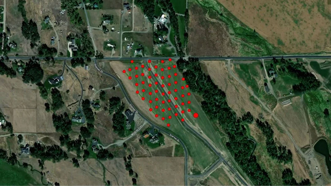
Surveying Drones: How to Use Drones for Surveying
Surveying drones can produce highly accurate topographic data faster, safer and at lower costs than a traditional land survey. This article will go into detail about how drones are used for surveying.
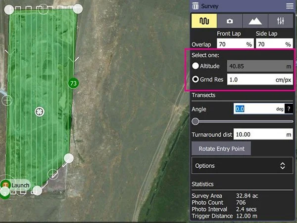
How to Plan a Survey Flight and Determine Ground Sample Distance in QGroundControl
Ground Sample Distance is a critical measurement in photogrammetry. This article covers how to use QGroundControl to determine your GSD.
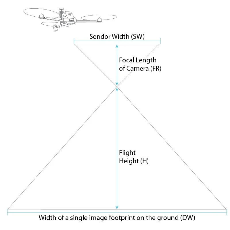
What is Ground Sample Distance (GSD)?
GSD is an important metric to understand in photogrammetry and is directly related to how accurate your survey is. This article explains how to calculate your GSD.